Sunday, August 29, 2010

HIGH DESERT MUSEUM


The High Desert Museum in Bend Oregon has many recreations of living situations from the past. This is a recreation of an old miners camp.

Sunday, August 22, 2010

GETTIN DOWN WITH THE BREHMS, 22 AUG. 2010


HOWDY FROM SUNRIVER/BEND ORGON

Things remain well for us all. We had a couple of nice trips from Twin Falls, ID. through Boise, and on to Burns OR. then from Burns on to Bend Oregon, where we are camped for a couple of weeks at the Thousand Trails, Sunriver Preserve. As we approached the preserve, we noticed lots of "EVENT" signs leading to various massive parking lots, shuttle buses, and signs saying something about a golf tournament. As we wiggled our way through the congestion, we realized we were camped almost next door to the PGA Open at Sunriver. After we got set up, we turned on the TV and there is was, being broadcast live.

We are happy to be here, nice weather; Down comforter at night, sweatshirt for the early morning walk, and tank top in the afternoon. We are 22 miles from Bend, so we will be able to get anything we need there. We are anxiously looking forward to hooking up with friends Andy and Linda, who are already up here somewhere, and Gene and Darlene, who are on their way up from Pio Pico in the San Diego area. As we were parking the motorhome here, we ran into our friends, Steve Dombrowski and his wife. After we leave this area, we will be heading toward the coast, where we hope to hook up with more friends, Glenn and Grace. Hope you all are doing well, love and God Bless.....

Ralph and Alice.............

OUR CAMPSITE AT TTN SUNRIVER


Lovely setting. Lots of pine trees, huge sites, the little Deschutes river, and the snow capped "Sisters" in the backround.

SUNRIVER TOWN SQUARE

One section of the camp is an "Old Time" town square. A semi-rickety boardwalk takes you past an old saloon, sheriff's office, courthouse, library, and of course the country store. Every building has carved characters of the towns people.

SUNRIVER ACTIVITY/DINING CENTER

This place has more food stands than you can shake a stick at. Ice cream stands, snack bar, bbq grill, and of course, the dining hall.

EXPRESSO ANYONE?


Yes, there it is, right on the campground property, an expresso chuck wagon. Open 6 am to 2 pm.

Sunday, August 15, 2010

GET DOWN WITH THE BREHMS, 15 AUGUST 2010


GREETINGS FROM POTATOVILLE, USA

Another wonderful adventure! We drove from Butte, Montana to Eden (as in the garden of......), Idaho. The drive was pleasant, and the campground very nice. We are about 15-20 miles North of Twin Falls, so everything we need is close by, even a Costco. The campground, in fact, most of the rural area is surrounded by potato, corn, and onion fields. We have seen the falls, a beautiful herd of elk, the countryside, and downtown. There is an Applebee's in Twin Falls, and it is a fatal sin to drive by an Applebee's without stopping to buy Diane lunch. I did good! might get lucky....

Next week we will head West again with Burns, OR. in our sights. From there to Bend, and Sunriver OR. and on to Junction City, near Eugene, for some home entertainment upgrades. We have an appointment for 9/7.

Hope you are all doing great, and having as much fun as we are. We are looking forward to our next get together. Love and God Bless.............


Ray, Diane, and our keepers.................

SHOSHONE FALLS


Ain't we just a couple of knockouts? Behind us are the stunning Shoshone Falls at Twin Falls, Idaho.

ELK BURGERS ON THE HOOF

There we were, just meandering our way down the Snake River gorge, when all of a sudden, I glanced up on the very edge of the gorges cliff. There were at least a dozen absolutely beautiful and huge elk looking down on us. They stayed there all the time we were down at the falls.

ELK, ELK, AND MORE ELK

Another incredible view. They just stand on the very edge and look down at the falls.

SHOSHONE FALLS


Note the rainbow at the bottom. Shoshone Falls is called the Niagara Falls of the West. It falls 212' which is 50' higher than Niagara Falls.

GODESS OF THE SHOSHONE FALLS


These are the beautiful Shoshone falls at Twin Falls Idaho. upstream (east) of the falls, is a dam used in hydroelectric generation. Usable energy through natures beauty! I made that up myself...

PERRINE BRIDGE

The I.B. Perrine bridge was built in 1976. It is 1500' long, and 486' above the Snake River. It is used year round for base jumping: parachutes and bungees.

SNAKE RIVER GORGE


This picture is taken from the "Falls" area, looking west toward the Evel Knievel rocket bike jump site. It's about a mile and a half from where we are standing. Can you believe that was 36 years ago??

Sunday, August 8, 2010

BREHM ADVENTURES AS OF 8 AUGUST, 2010


GREETINGS FROM GARRYOWEN, MT.

We came to Garryowen as a stopover between South Dakota and Idaho. We also wanted to visit the Little Bighorn Battlefield again. Our two day stopover has turned into a week. Sure is nice to be flexible and do what feels good. We hit storms from the time we left Sturgis until we were well inside the Montana border. So bad at one time, we had to pull off the road for a spell. Raindrops the size of tennis balls, winds about 60 mph, and visibility like an unlit basement. Deadwood got hit so bad they had 4 ft. of hail on the ground and in basements. Took them a few days to clean up. It has been gorgeous here, but we did have a T-stom one day where it rained and blew for 45 minutes. The wind was blowing the passenger side slideouts in, so Diane and I had to keep them pushed out til it passed. We will depart this camp on tues. and head west.

Everybody, including the fur people are doing well, we hope you all are, as well. Till we see you again, love, laugh, be well, and God Bless................

Adonnis & Cleopatra................

NICE IRON ADORN THE STREETS


Mostly Harley owners come to these rallies, but as you can see, there are Indians, Victories, BMWs and even an occasional Honda.

MAIN STREET, HWY 16A, THROUGH KEYSTONE


The bikers are starting to gather.

THE BOARDWALK IN KEYSTONE, SD

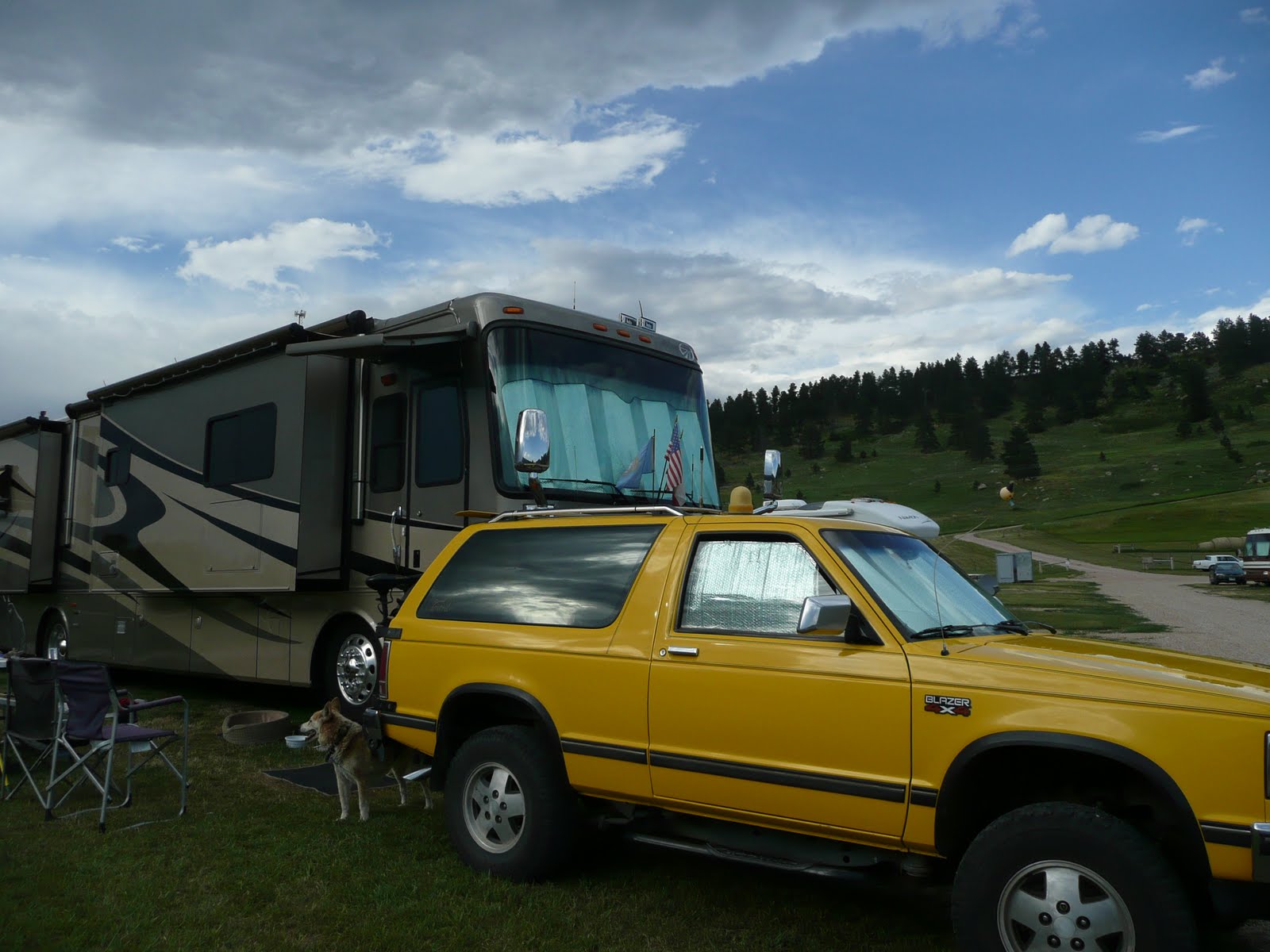
Keystone is a small western type town just below Mt. Rushmore. This time of the year, it becomes one of the favorite stopovers for bikers on their way to Sturgis.

BIG SKY SUNSET

Pretty much a daily feature in the high plains. Happens between 8:30 and 9:00 pm.

"LAST STAND HILL"


This is "Last Stand Hill" and the last place Custer and his small contigent of soldiers could run at the Battle of the Little Bighorn. The grave markers were placed where the soldiers fell. The marker with the black shield, is Custer's.

OUR CAMP AT THE 7TH RANCH


The camp at 7th Ranch is built on a hill that rises out of the plains and the Little Bighorn River, very similar topograghy to the battle site. We are camped at the very top of the camp.

Diane with old Yellow Hair Hisself

This is the Museum at Garryowen. The villiage is on the Crow Reservation, and consists of a Conoco gas station, a museum sits where Sitting Bull camped during the Battle of the Little Bighorn, and a campground, "The 7th Ranch", where we are camped.

STORM IN THE SOUTH


From our camp in Garryowen, MT. We have a thunderstorm that comes from the South almost everyday. They last from 10 minutes to a half hour, and make the day a little more interesting.

Sunday, August 1, 2010

STURGIS UPDATE, 1 AUGUST, 2010


GETTING READY TO HIT THE SUPERSLAB

Howdy friends and family and others. Another interesting week in Western South Dakota. Made a trip or two into Rapid City, took care of some business, picked up our mail, and met with our friend Dixie and her friend, John for lunch at the Firehouse Brewery. We had a nice visit, but almost immediately after we split, John became ill and Dixie had to take him to the VA Hospital in Sturgis. John is home now and doing well. We took a day trip to Deadwood for a visit, left some gelt at a couple of casinos, and had lunch. We then took a drive up to the town of Lead (Leed) which is an old mining town but is being nicely restored and reinhabited. From Lead we drove through Spearfish Canyon to the town of Spearfish. Great road trip! Black Hills scenery with the river running along side the road.

After 3 tries at trying to get a permit for personal security, we finally suceeded, but it took a lot of negotion and pleading with knee pads on. Seems they cease issueing permits during the Rally period, which is now. But after involving the Meade Co. sheriff and the Secretary of State at the Capitol. We got it. We are exceptional! Day after tomorrow, we hit the road again, heading west through Wyoming & Montana. Y'all take care now! See youse down the road...

Carlos & Willie.............

WELCOMING STREET BANNER

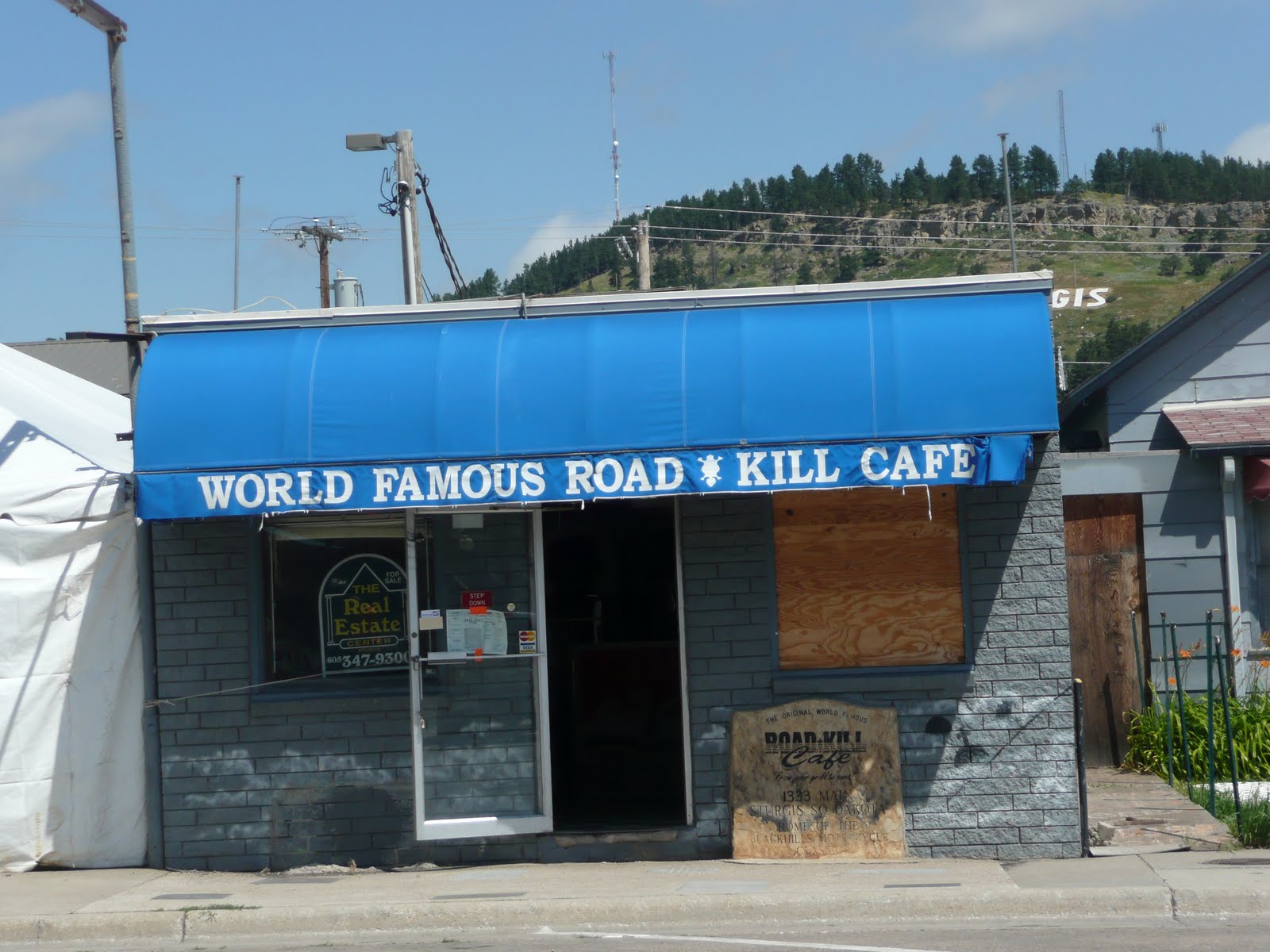
If you are interested in this Sturgis thing, check out the web sit on the banner.

FAMILY PORTRAIT


Bikers hang out here!

GUNNER'S PHILOSOPHICAL SOCIAL CLUB

If you can't find a place to get a drink and hear loud music, you ain't in Sturgis!

ONE EYED JACK'S LOGO

This boy's missing more than an eye! Fun place....

RAT BIKE DOWAH DIDDY DOO


You can see all kinds of machinery at a motorcycle rally. Sturgis is no exception. The owner of this old 49 has probably got a fortune invested in this.

MAIN ST., DEADWOOD


This is the street frequented by Wild Bill Hickok, Calamaty Jane, and a host of other interesting characters. Mostly casinos, restaurants, bars, and gift shops now, but in a very quaint 1876 way.

THE "HOLLYWOOD & VINE" OF DEADWOOD

This is the West end of the main part of downtown Deadwood. Although the town has had some devastating fires, it recovers everytime and looks like it did 100 years ago.

SPEARFISH CANYON


The drive from Deadwood to Lead to Spearfish Canyon is breathtaking. Black Hills, as you see here, waterfalls, shear banks and cliffs on either side, and the river running alongside the road.

Sunday, July 25, 2010

DOWN WITH THE BREHMS, 25 JULY, 2010


STURGIS, SOUTH DAKOTA

Greetings to all who viist this BLOG. We are camped in Sturgis, about 25 miles west of Rapid City. We love this campground. It is clean and green, lots of wildflowers, quiet and the owners are real friendly. We are close to Mt. Rushmore, Custer Nat. Park, Deadwood, and a host of other attractions. The Sturgis Black Hills Motorcycle Rally starts on the 6th of August, and this little town grows from 7000 to over 600,000 for a week. We were hoping to get out of here before the madness, but due to some time requirements with Meade County, we will remain here until the 15th. Due to previous reservations, we will have to move from our lovely spot to a very similar site, but it will be dry camping for a week or so, no problemo.
Sturgis is starting to morph into "Bikerville", new signage, T-shirt tents opening up on every street corner, campgrounds being groomed for a million tents. The city streets will be blocked off for motorcycles and emergency vehicles only.
Hope all of you are enjoying your summer and are well and happy. Stay in touch, hope tp see you soon..............
Harley & Davidson....

OUR STURGIS CAMPGROUND


THE KNUCKLE SALOON

Home of the famous Knuckle Sandwich, huge bar and restaurant, with it's own radio station, volley ball court and bull riding ring.

AN ABUNDANCE OF ENTERTAINMENT


LOUD AMERICAN ROADHOUSE


If you haven't been to Sturgis this time of the year, you would not believe how big these places are.

ONE EYED JACKS


One of our favorite hangouts. Huge log cabin type construction with long bar and restaurant, plus volleyball court.

"ROAD KILL CAFE"


The plaque to the right of the door recites the motto of the Road Kill, "From your Grill to Ours"

The name of this bar reflects the state of the whole town


This bar will probably remain open for just two weeks a year.

Sunday, July 18, 2010

THIS IS THE WEEK THAT WAS, AS OF 18 JULY, 10


Best Regards from Sturgis, South Dakota

Howdy friends, thanks for visiting us here on the BLOG. Thank goodness for digital cameras, we couldn't share these with you or afford to take them otherwise. What a great week, most of it in Moab. Besides the everyday fun and beauty of the place, we took a 74 mile jet boat tour down the Colorado River through Canyonlands Nat. Park. The trip was a blast, and views breathtaking. We also took an off-road trip in the Blazer on the Schafer trail, about 50 miles from the River at the bottom up to the rim at Dead Horse Point. Pretty challenging trip. We couldn't take pictures at the scarey parts because I was trying to keep the Blaze on the trail. There were a half a dozen switchbacks going almost vertical and doing a 180 in 20-30 ft. Yikes!
And it was steep, at one point we climbed over 1000 ft in 2 miles over a rocky trail with scattered gravel. What a friggin blast.
We didn't decide which way to go when we left Moab until Friday. We decided to head for South Dakota. The first leg was to Golden CO. Good trip, but steep through the Rockies, especially East of Vail, 11,200 ft alt. then down to about 5200 ft in Golden. Felt like we were either going straight up, or straight down. We camped at an "Encore" park in Golden. Never again. Please ask us for details before you stay there. After about a half hour of "cut and fill" to get out of the damned spot. We hit the road, planning on spending the night in Wyoming. Too much going on with rodeos etc. We finished the day at Sturgis SD. The huge motorcycle rally starts in a few days, and this little town grows by 500,000 peoples min. We never plan it but always wind up here a week before the two wheeled zoo. Oh well, we'll be here a couple of weeks. Hope you are all having a great summer and look forward to seeing you and hearing from you soon

Speeding down the Colorado River

Our 74 mile jet boat trip was a thrill, as well as beautiful and informative.


Moab reflections


We took so many beautiful pictures from the boat showing the reflections of Canyonlands.

Blue Herron in nest

From the boat, we looked up on the steep cliff, and

there was a beuatiful Blue Herron sitting on it's nest.


Beached Jet Boat and Diane

At one point on our jet boat trip, the boat was beached so we could hike up the bank and look at some petrified logs and ancient sea creature fossils.


Rocky trails through Canyonlands


The Schafer Trail, which leads from the top of Canyonlands to the Colorado River, at the bottom is primarily over rock, so it's bumpy and slow.

Hey, where did the trail go?


There are places on the Schafer trail where you are not sure if you are on trail or not. We were lucky. If we ever lost the trail, we found it again up ahead. So much fun..........

MOAB ROCK MONSTERS

The trail just brought an unending assortment of views around every corner.


THE TRAIL


This is just a chunk of the 50 mile off-road experience.